
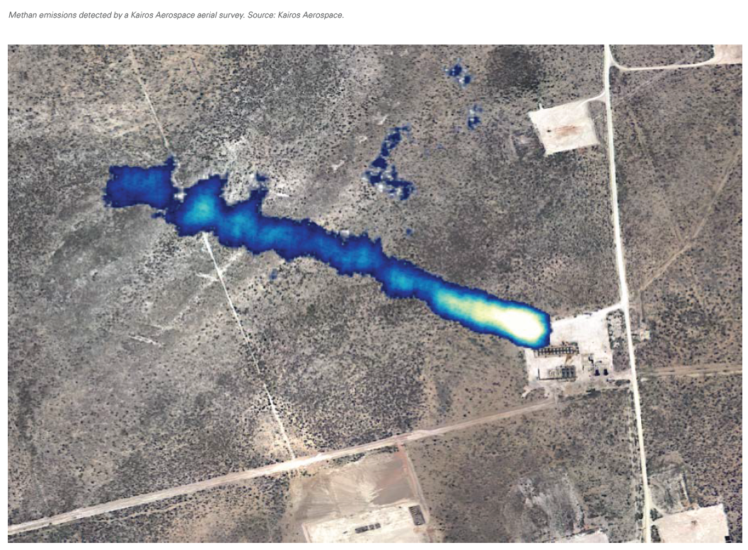
Kairos Aerospace: Aerial surveys to find the largest methane leaks faster [Gas in Transition]
Q: Can you tell us about how Kairos Aerospace is operating to assist oil and gas companies in achieving their environmental goals and retaining more of their product by reducing methane leaks?
A: Our primary goal is to help our customers reach theirs, so we treat our customer relationships more like a strategic partnership than a transactional vendor/customer relationship. We start by getting a deep understanding of the operator’s goals and motivations for each basin in which they have assets, because not only do goals vary significantly operator-to-operator, they can also be quite different for the same operator in different basins. For example, operator goals can: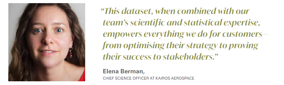
|
Advertisement: The National Gas Company of Trinidad and Tobago Limited (NGC) NGC’s HSSE strategy is reflective and supportive of the organisational vision to become a leader in the global energy business. |
- Be environmentally-focused
- Be profit-focused
- Be focused on improving compared to peers in their basin
- Be focused on defending their brand from activist naming and shaming
At Kairos, we believe that a strong methane strategy starts with a strong partnership. That’s why we’ve developed a few unique capabilities to help our customers determine their ideal methane strategy, execute it, and then prove their results.
One such capability is our new optimiser tool, which can help an operator find the ideal survey sensitivity and frequency to reach their individual goals. The other key capability is benchmarking how well an operator is doing compared to others in their basin in terms of their methane emissions.
All this is made possible by our unique approach to aerial methane emissions surveys. Unlike other providers, we fly the entire basin—not just the assets of our customers—and collect a massive amount of data. This dataset, when combined with our team’s scientific and statistical expertise, empowers everything we do for customers—from optimising their strategy to proving their success to stakeholders.
Q: What are some of the advantages of utilising aerial surveys to detect methane leaks as opposed to traditional methods such as ground-based leak surveys?
A: On this point, Top Gun’s “Maverick” said it best: “I feel the need–the need for speed.” Aerial surveys are much faster than their ground-based counterparts. And a whole host of benefits flow from the ability to find leaks faster. First of all, going faster saves time. A full survey of hundreds or thousands of facilities can be completed in just weeks or even days. That in turn saves money, because it drastically reduces the personnel intensity of leak detection work.
Second, going faster means you can fix leaks faster. When you can drastically shorten the duration of your leaks, you’re reducing more emissions (because your leaks won’t persist for as long) and you’re saving money by putting that leaking gas back into the sales line faster.
Of course, there are significant safety benefits as well. Aerial surveys immensely cut down on the single biggest risk to field personnel–driving time. Driving is one of the largest sources of fatal workplace accidents in the oilfield, and getting personnel off the road has material safety benefits.
Q: Technological advances present the oil & gas industry with an enormous opportunity to utilise data and improve asset performance. Can you tell us about how your technology is driving operational efficiency gains for customers?
A: The future of performance and operational efficiency is tied to two key things: determining the best, most efficient strategy to reach operator goals, and tangibly proving that they’ve reached them once the strategy is enacted. As I mentioned before, our optimizer tool and benchmarking capabilities allow us to significantly advance customer performance over time.
The optimizer is our proprietary tool that leverages our methane emissions dataset—the largest in the world— along with peer-reviewed scientific research to accurately predict the best survey frequency and sensitivity to reach a customer's goals. It uses customer-provided inputs—such as repair cost and expected gas price—and that customer’s historical emission profile collected from frequent Kairos surveys to run thousands of simulations. The outputs allow customers to see what their results would look like with different methane strategies, ensuring they’re able to select the best path forward for their goals.
Once the customer has enacted the strategy, our dataset also helps them gauge their success compared to other operators in their basin. Most customers find that they move up the benchmarking ranks by focusing on more frequent flights at a medium sensitivity, but the perfect solution varies by operator and basin.
Q: Sometimes small and medium-sized operators are hesitant to embrace methane detection solutions due to fears that there will be operational disruption, or that a large capital investment will be needed. How does your solution address these concerns that small and medium operators may have?
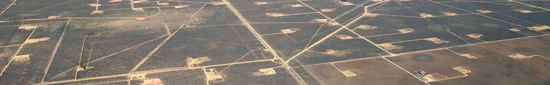
A: The benefits of the scale of aerial monitoring are oftentimes most strongly felt by these very same small and medium operators. Kairos is in the business of surveying entire basins, not individual sites. Last year, we surveyed more than 85% of the production in the Permian Basin which by some measures is the world’s largest oilfield.
At scale, aerial surveys are far more cost-effective than ground-based visits, sometimes as low as 10% of the cost of a ground site visit. In areas where we’re already flying for your neighbours, we do everything we can to make the cost of an aerial survey attractive to you. We’re able to spread important costs like hangar space across all projects, so no single operator needs to bear the full burden.
Some of our most successful projects have been with companies operating 100-200 producing wells.
Q: For larger operations, often there are areas at facilities that are difficult to access by ground. Are aerial surveys the best solution then to detect any abnormalities in difficult to reach places?
A: Aerial surveys offer the benefit of not requiring any site access to survey for leaks. Even though Kairos uses aerial techniques to pinpoint emissions and we’re very proud of what we do, aeroplanes are certainly not the only way to find emissions. Drones, manned aircraft, and even satellites all can survey for emissions without site access.
At Kairos, we’re firm believers that there is no single one-size-fits-all solution in this marketplace. That’s why our approach is to work directly with each individual company to understand their methane program objectives and their unique operational needs and help them identify the right approach to eliminate methane–even if it isn't with Kairos technology.
 We offer adjustable sensitivity and operational flexibility to give companies options to design the most efficient leak detection program for their operation’s footprint.
Q: Beyond methane leaks, are your aeroplanes able to measure or detect VOC emissions or other leaks?
A: The underlying core of our technology works for other gases, but today we’re focused exclusively on methane emissions. That said, it is important to note that if you want to identify non-methane emissions, methane is often the dominant gas when we look at gas composition analyses. So by searching for methane, you will find leaks containing a number of other gases of interest, such as VOCs.
Q: Which regions and basins are you currently conducting aerial surveys for? Do you have plans to expand your operations to any new localities in the near future?
A: Today, Kairos operates in 19 oil and gas basins across North America. The heart of our operations is in the Permian Basin of west Texas and southeast New Mexico, but we’re flying monthly across many of North America’s largest oil and gas plays. This year, our Canadian operations will involve surveys in British Columbia, Alberta, and Saskatchewan. We’ve also seen terrific results outside of North America as well, and have ongoing operations in Colombia and Argentina. And we are expanding to new locations every year.
The biggest area of growth we see is being able to survey more frequently throughout the year. Methane emissions are largely driven by larger sources that emit the bulk of a company’s fugitive gas. To put it another way, a very large but rare source of emissions like an unlit flare or open thief hatch has the potential to emit the same amount of methane in a matter of just a few days that would be conserved by hundreds of pneumatic controller change-outs over the course of a year.
We see in the recent scientific literature that being able to survey for leaks as frequently as possible is the single biggest lever companies have when it comes to reducing methane, and our growth is really focused on making that a reality at the lowest possible cost for the industry.